

Many parts of the US infrastructure such as levees, dams, bridges and roads have deteriorated to a point that they may not withstand a catastrophe or the use to which they would be put during a disaster. By Paul Mlakar
An ounce of prevention is worth a pound of cure. Many of us – engineers, planners, politicians and builders – repeat this wisdom as we strive to take preemptive action against future events. Unfortunately, no matter how many times we repeat it, the message often registers too late.
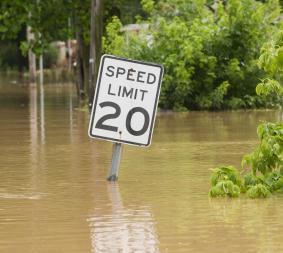
Witness this news, which was reported 15 June in the Des Moines Register, a daily newspaper in Iowa, a state ravaged by flooding in the summer of 2008. The first sentence of the article echoes a story we have heard many times before:
“An earthen levee that burst Saturday under the pressure of the Des Moines River and led to the forced evacuation of north-side Des Moines neighborhoods was outdated and in need of replacement, and had been a known weak spot in the city's flood control system for decades.”
In this particular case, the US Army Corps of Engineers (USACE) had a plan to implement “an ounce of prevention” for the 4.3m (14 foot) levee, but did not have the necessary $12 million for construction and was slowed by environment-related public controversy. Needless to say, the ultimate cost of evacuation, property damage and cleanup will vastly outweigh the expense associated with the planned preventive work.
Beyond reinforcing the value of prevention, this example highlights what increasingly has become a quiet, but alarming trend in infrastructure: the inability to quantify the effects of deterioration in the overall scheme of risk management. Intuitively, we know that a weathered roof is more likely to leak in a deluge, and that a cracked window will be predisposed to shattering in a windstorm. But infrastructure vulnerabilities are rarely so visible. Worse, the cost of detecting these weaknesses stretches the budgets of many state and local governments, as does the funding needed to fix the weaknesses.
However, due to its negative impact on the ability of the United States to respond to disasters, detection of deterioration, and its quantification, are essential. At the US Army Engineer Research and Development Center (ERDC), we are exploring new ways to illuminate how deterioration increases risk (see text box), as well as identifying techniques to more adeptly address deterioration before it can exacerbate the effects of a catastrophe through infrastructure failure.
Flooding – levees and rivers
Like the Midwest floods, the lessons of recent hurricanes such as Katrina in 2005 shape our work. For example, the USACE has established an Actions for Change initiative as a means to manage the corps' portfolio of dams, as well as the nation’s portfolio of levees, in a risk-informed framework. Our work dovetails with that of organisations such as the US Bureau of Reclamation, which uses a risk-informed decision process in its own dam safety programme, and the Federal Energy Regulatory Commission, which is seeking to understand the probability and consequences of infrastructure failure more consistently.
As part of an interagency task force involved in post-Katrina investigations, we spent significant time peeling away the causes and effects of failures in the levee system in New Orleans. The system breached in 50 different locations throughout the area. Of the 50, in four cases we found that the levee-floodwalls breached before the water reached the design elevation, indicating that the design of the levee-floodwalls was inadequate.
In the 46 other locations, we determined that the breaches were the result of water levels rising up to and over the levee’s crest. Because the upper edges of the levees were never armored to resist water flow over the crest, these areas were vulnerable to quick erosion through scour. In some levees constructed of poorly compacted erodible materials, a trickle over the top created a rut, which ultimately deepened and widened making the entire section crumble. Other levees, constructed of compacted clay soil, were able to withstand overtopping without breaching.
Unfortunately, weakness in any link in a chain of levees can result in catastrophic loss. What is troubling is that levees across the nation exhibit this potential weakness. In fact, in 2007 the USACE reported that nearly 150 US levees pose an unacceptable risk of failing in a major flood, mainly due to poor maintenance. Sadly, these 150 levees represent only those owned by the Corps. There are possibly many thousands of miles of levee that may be at risk – undocumented in any inventory. In other words, not only do we not know how many levees are truly at risk, we also do not know how many levees there are, nor even where they are.
“In essence, the roads can become less of an escape route and more of a gauntlet to be run.
Adding additional risk is the condition of the nation’s dams: the American Society of Civil Engineers (ASCE), in its 2005 Report Card for America’s Infrastructure, notes that the number of unsafe dams has risen by 33%, to more than 3,500, since 1998. The group’s report card gives our dams a grade of D (poor).
In the wake of Katrina, my colleagues and I have been pursuing projects that address Katrina issues. One involves modelling the hydrodynamics of hurricane landfall and another deals with risk analysis. In the infrastructure arena, our focus is on deterioration; we see the time and money spent on dealing with this aspect as being more effective, with a better return on investment than solely focusing on extreme events.
For example, USA Today reported on 25 July 2008, that since a fatal Minneapolis motorway bridge collapse in August 2007 delivered a national wake-up call, states have ramped up their bridge inspections. The newspaper said that as a result, 16 states have closed bridges, reduced their weight limits or made repairs.
The threats posed by Gulf Coast hurricanes are significant, but an area even more vulnerable to flooding is far from their reach. In California, the Sacramento River runs through some of the nation’s most critical farmlands, busiest business centers and largest population concentrations. With so much at stake, you would imagine that the condition of levees along this river would be among the best in the world. Yet, on the USACE’s 2007 list of approximately 150 at-risk levees, 19 protect people from potential flooding by the Sacramento River.
Not surprisingly, this risk has captured the attention of California lawmakers; after all, their capital, Sacramento, and its people could be victims of levee failure. An independent review panel reported to the California state government in October 2007, that certain combinations of weather and levee failure could swamp the city in 20 feet of water and generate $25 billion in damage. Broader flooding could also occur, killing as many as 500 and putting more than 100 square miles under water, according to the panel’s report, A California Challenge – Flooding in the Central Valley.
Situations such as these demand that we apply our professional expertise and the best technologies to detect deterioration early. An array of sensors and sophisticated modelling software have given us new tools, but the key is the political will and funding to get the right people to make decisions and focus the work where it will do the most good.
Evacuation – roads and bridges
In terms of flooding, Hurricane Katrina was among the strongest storms ever to strike the US coast and its effects were devastating, particularly in New Orleans. Pre-storm evacuation efforts were largely effective: as many as 80% of the city’s residents were able to leave in two-day period before the hurricane made landfall locally.
Much of this rapid evacuation hinged on the coordinated efforts of regional authorities and emergency teams whose strategies involved reversing motorway lanes to allow swift movement north and away from the hurricane’s path.
Less noticed, however, was the resiliency of roads and bridges in the region, which withstood the strain of extraordinary loads of traffic, compressed into small periods of time. Bridges that seem strong when handling routine flows of normally spaced vehicles can suddenly become unsettling question marks as bumper-to-bumper traffic settles on their aging pilings and spans.
We know that more than 4 billion vehicles safely cross 599,766 bridges in the United States every day. Yet according to the Federal Highway Administration’s (FWHA) 2007 National Bridge Inventory, 25.4% of these bridges are rated structurally deficient or functionally obsolete. This accounts for 152,316 bridges. These bridges either have deteriorated enough that they need to be monitored, repaired or replaced in order to remain in service, or they have been identified as having physical features, such as lane widths or vertical clearances, that do not meet today's standards. Not surprisingly, these bridge conditions have earned a grade of C (mediocre) on ASCE’s 2005 Report Card for America’s Infrastructure.
“The threats posed by Gulf Coast hurricanes are significant, but an area even more vulnerable to flooding is far from their reach.
In the course of a normal day, such inadequacies are woven into the traffic patterns of a city or town, with truck routes, for example, structured to avoid certain bridges and roads. But, in a catastrophe, the rules change. Ponder this question: If a river of mud or a raging wildfire were at your back, but your truck’s weight exceeded the restriction of the bridge in front of you, would you drive forward anyway? I offer this scenario because, when lives are at stake, we know that our infrastructure will be stressed extraordinarily, both in terms of traffic flow and inappropriate vehicle weights and dimensions. What happens when these loads intersect with deteriorating bridges?
For purposes of illustration, let’s look at a deterioration-related bridge failure that took place almost exactly 25 years ago in Connecticut. The Mianus River Bridge is part of Interstate 95, located in one of the busiest stretches of this heavily traveled highway. In June 1983, approximately an hour after midnight, a 30m deck section of the bridge collapsed, killing three people and injuring others.
What was the straw that broke the camel’s back? It was a simple combination of vehicles, two heavy trucks and a car, crossing the section at the same moment. Subsequent investigation linked the collapse to corrosion and eventual failure of pin-and-hanger assemblies that had been weakened by corrosion.
Investigators believe the corrosion could have been detected earlier. However, at the time just 12 engineers, working in pairs, were responsible for inspecting 3,425 bridges in Connecticut. Twenty-five years later, our process for evaluating bridges may be more refined, but transportation departments continue to struggle to fund inspections, as well as repair the inadequacies these probes uncover.
The question we face is this: if components of key bridges were to fail under extreme stress – such as that brought on from fleeing citizens in situations of natural or man-make disasters – how many more lives would be put at risk unnecessarily?
While bridges may represent a particular weak link in evacuation plans, roads themselves also may perform unevenly when put under extraordinary traffic loads. Part of the reason is that there are simply not enough roads, even on a normal day. According to the transportation research group TRIP, highway travel in the U.S. rose 41% from 1990 to 2006; during the same time period, the nation’s miles of roads increased only 4%. This concentration of traffic results in extensive wear and tear – 33% of the major roads in the United States are in poor or mediocre condition.
Limited roadways and deterioration also create persistent traffic snarls. The group reports that 36% of major US urban highways are congested, a state of affairs that costs citizens 3.5 billion hours a year in wasted time while they idle in traffic. This combination of deterioration and congestion has earned US roadways a grade of D (poor) on ASCE’s Report Card for America’s Infrastructure.
Such constraints in so-called normal traffic situations can become dangerous bottlenecks when literally millions of people jam highways as they flee catastrophes. In essence, the roads can become less of an escape route and more of a gauntlet to be run.
When looking at our disaster plans, we must evaluate the infrastructure on which safe transportation relies, analyse its condition and then take corrective action. As we noted earlier, the technologies are increasingly available to keep small problems from creating catastrophes. For example, our team is working on techniques for electrokinetic transport of liquids into concrete, which is allowing us to drive chloride ions out and reduce its corrosion of imbedded metals.
Stepping up to the challenge
The management of risk is complex, and many political and economic factors must be weighed in decision-making. Too often, the impact of deterioration is ignored or underestimated. By devoting the right planning and construction resources to address deterioration, we can make headway in raising the grades on ASCE’s Report Card for America’s Infrastructure, which in itself will be a significant achievement. And, as a bonus, we will minimise the role deterioration may play in a catastrophe, helping to ensure that our infrastructure is ready to respond when people need it most.
Risk = hazard x fragility x consequences
Traditionally, we have calculated risk by multiplying factors representing the level of hazard and the expected consequences in an extreme event. Since Hurricane Katrina, however, the US Army Corps of Engineers (USACE) has begun to supplement this equation to introduce the potential influence of infrastructure fragility. As such, even though the hazard and consequences of a failure may be equal in various scenarios, risk ultimately increases if infrastructure has deteriorated when subjected to an extreme load.
In this revised risk equation, we define the factors in this way:
• Hazard – Probability of an extreme event, such as a flood with an annual probability of 1 in 500, assuming this event is independent of infrastructure condition.
• Fragility – Probability of infrastructure failure, such as a levee breach, which increases based on level of deterioration of this infrastructure.
• Consequences – Actual loss of lives, or economic damage, or environmental harm that is independent of this infrastructure (such as loss of buildings, homes, farmland, etc.).
By introducing fragility into our analysis as engineers and infrastructure managers, we can more ably communicate the implications of neglect when it comes to identifying problems and funding remedies for deteriorating infrastructure in our communities.
Postscript
Paul Mlakar is a senior research scientist focusing on the response of structures to extreme loads at the US Army Corps of Engineers’ Engineer Research and Development Center, in Vicksburg, Mississippi. He also is chair of the ASCE Committee on Critical Infrastructure and a member of the 2009 Report Card for America’s Infrastructure Advisory Council. His experience in catastrophe management draws on lessons he learned in studying the partial collapse of the Pentagon building as a result of the terrorist attack of September 11, 2001, and in examining the failure of the flood protection system in the New Orleans area during Hurricane Katrina.
www.asce.org


No comments yet