


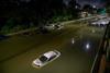
Laura made landfall as a category 4 hurricane with wind speeds of up to 150mph and an “unsurvivable” storm surge
Laura is currently moving inland as a Category 3 hurricane across southwestern Louisiana, according to the National Hurricane Center (NHC). It is the strongest storm to hit the US state in 160 years.
A National Ocean Service tide station at Calcasieu Pass, Louisiana observed a water level rise of 9.19 feet. In Lake Charles, Louisiana, the airport reported a sustained wind of 98 mph (158 km/h) with a gust to 132 mph (212 km/h).
A Weatherflow site in Cameron, Louisiana reported sustained wind of 92 mph (148 km/h) and a gust to 117 mph (188 km/h) in the southern eyewall of Laura after the eye of the storm passed overhead.


No comments yet