Currently, Zeta’s track is a direct landfall for New Orleans, with the storm taking a similar path to Hurricane Katrina in 2005
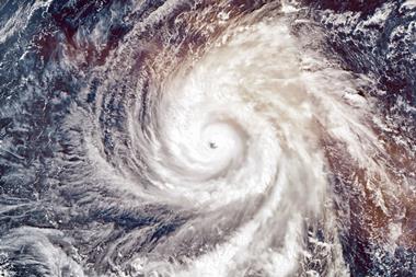
Hurricane Zeta is expected to make landfall on the Louisiana coast in the next few hours. The storm, which has already landfall on the Mexican Yucatan peninsula, has regained in strength as it headed north across the Gulf Coast towards Louisiana. It is currently a category 1 storm with windspeeds of up to 95 mph.
The US National Hurricane Center said in its forecast of a category 1 hurricane meant the storm was capable of ripping shingles off roofs, tearing branches off trees and downing power lines.
Currently, Zeta’s track is a direct landfall for New Orleans, with the storm taking a similar path to Hurricane Katrina in 2005. From a named storm perspective, the current Atlantic hurricane season is just one short of the record reached in 2005.
The late season hurricane has a storm surge that is expected to reach five to eight feet above normal tide, which may test New Orleans’ extensive flood defence system, with the levees strengthened and rebuilt since the city was devastated by Katrina 15 years ago.












No comments yet